Groundwater Recharge Decision Support Tool
To address the increasing need for information to locate the best sites for recharge that have the potential to improve water quality and benefit communities and ecosystems, we have developed a decision support tool.
Key features of the Tool:
-
Uses ArcMap, a GIS analysis software
-
Analyzes multiple geospatial datasets
-
Transferrable to any groundwater basin in California's Central Valley
-
Prioritizes geographic areas where surface & subsurface conditions are more suitable for recharge projects
-
Includes the following optional considerations:
-
contamination cleanup sites
-
existing conveyance infrastructure
-
reported dry domestic wells
-
ecosystems that are dependent on groundwater
-
-
Users can adjust certain features for different priority outcomes
Tool output: a multi-benefit recommendation for recharge sites that is tailored to the needs of each region.
Step 1: Suitable Locations for Groundwater Recharge
The maps of the Sacramento and San Joaquin Valleys below show the results of our tool up to the suitable recharge locations step. We reached this result by analyzing land use type, water infiltration and storage capacity and the risk of nitrogen contamination. It displays a relative ranking of suitable recharge locations from better (green) to worse (red). Results vary depending on the scale and extent of the selected output area.


Sacramento Valley, CA
San Joaquin Valley, CA
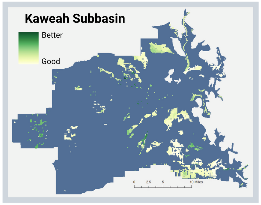
This tool can yield results for any basin in the Central Valley. The maps below show the top 10% of suitable recharge locations in a number of basins throughout the Central Valley, where yellow is good for recharge and green is better for recharge.
Our tool builds on this base output by allowing users to weigh additional considerations based on their local priorities. See Step 2 for example results.
Step 2: Including Additional Considerations to Locate Multi-benefit Recharge Sites
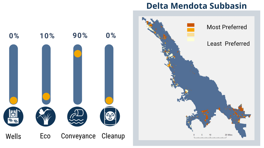
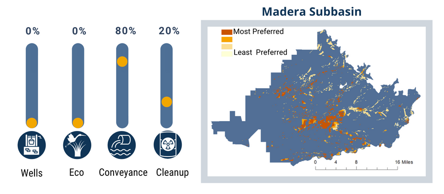
A user has 100% to allocate between the four additional considerations. Below are a few hypothetical examples of customized weighting. The maps display a ranking of the best places to achieve the selected benefits within the suitable recharge locations. Darker orange locations are the most preferred regions to achieve the selected benefits, and pale yellow are the least preferred regions. All locations in the orange to yellow scale are within the top 10% of recharge suitability for the selected basin.


